What is the Sirocco wind?
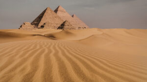
The Sirocco is a hot, dry, and often dusty wind that originates in the Sahara Desert, particularly over Algeria and surrounding regions. It forms when low-pressure systems pull warm air northward across the desert.
As this air mass moves, it absorbs fine الرمال (sand particles) and becomes extremely خشک and گرم, often carrying dust آلاف kilometers.
How the Sirocco forms over Algeria
The process typically begins when:
- A low-pressure system develops over the Mediterranean
- Hot air rises over the Sahara, creating upward جریان
- Cooler air from the north pulls desert air toward Europe
Temperature ranges in southern Algeria during Sirocco formation can exceed 40°C, especially in spring and early summer.
The journey across the Mediterranean
Once the Sirocco leaves North Africa, it travels across the Mediterranean Sea toward southern Europe.
During this phase:
- The wind picks up moisture from the sea
- It becomes humid and sticky rather than dry
- Dust particles remain suspended in the air
This transformation is why the Sirocco feels very different in Europe compared to its desert origin.
Impact in Southern Europe
Countries like Italy, Malta, and southern Spain are frequently affected.
Typical conditions include:
- Temperatures rising to 30–38°C even outside peak summer
- High humidity levels above 70%
- Reduced visibility due to dust haze
- “Blood rain” when dust mixes with rainfall
In Italy, the Sirocco is locally known for creating oppressive, uncomfortable weather, especially in coastal cities.
Seasonal patterns and timing
The Sirocco is most active during:
- Spring March to May
- Autumn September to November
These seasons see more frequent pressure changes across North Africa and the Mediterranean, allowing winds to travel long distances.
Environmental and health effects
The Sirocco has both short-term and long-term impacts:
- Air quality drops due to fine Saharan dust
- الأشخاص with asthma or respiratory issues may experience discomfort
- Agriculture can suffer from heat stress and dust deposition
- Visibility disruptions can affect aviation and transport
Satellite data often tracks these dust plumes moving directly from Algeria into Europe within 1 to 3 days.
Why it matters for weather forecasting
For meteorologists, the Sirocco is a key indicator of:
- Cross-continental weather linkage between Africa and Europe
- Dust transport affecting climate systems
- Sudden temperature spikes in Mediterranean regions
Forecast models now closely monitor Saharan pressure systems to predict Sirocco events more accurately.
Final insight and safety tip
If you are in southern Europe during a Sirocco event, limit outdoor exposure during peak dust ساعات, stay hydrated, and keep windows closed to reduce indoor dust دخول.